The site
The site is located on land off Sydney Road and Maw Green Road, and occupies a highly sustainable location to the north-east edge of Crewe.
The proposed development site (Crewe Northern Gateway – Phase 3) comprises approximately 65 acres (26.4 hectares) of green field land, principally farmland which has been used for grazing animals, and is located to the north-east edge of Crewe.
The land immediately west of the site (Crewe Northern Gateway – Phases 1 & 2) benefits from various planning permissions for residential development public open space including children’s play areas, and associated infrastructure works.
To the west is Maw Green Road and the railway line that heads north out of Crewe to Sandbach. The surrounding land to the north and east is largely rural, with some Minerals and Waste Development located wider to the north west, in the form of the Maw Green landfill site, which is in the process of being decommissioned and capped.
The current access to the Site is via Maw Green Road to the north western corner of the site.
Sustainable Location and Accessibility
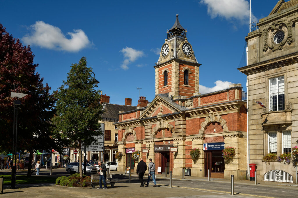
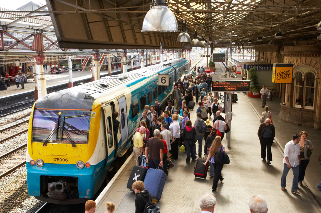
The site is located on the edge of Crewe, which is identified by the Cheshire East Local Plan as a Principal Town. Crewe has a good range of local services, (schools, healthcare, public houses, shops, community facilities, sports provision and places of worship), access to public transport (rail and bus) and access to employment. The Site also has easy access to the M6 motorway and the wider Strategic Road Network.
In terms of pedestrian and cycling accessibility the site itself can access a footway provided on Sydney Road. The site is also well placed to access local bus services.
The proposed development site is sustainably located given its location on the edge of a Principal Town and would minimise the dependence on the use of the private car.
Cheshire East Local Plan – Policy PG 2: Settlement Hierarchy
Locating the majority of new development needs in, on the edge of, or close to the borough’s Principal Towns and Key Service Centres will enable the maximum use of existing infrastructure and resources and allow homes, jobs and other facilities to be located close to each other. This has the potential to reduce the amount of people reliant on travel by car and can support existing public transport modes. The Principal Towns and Key Service Centres also have the greatest potential to generate economic growth.
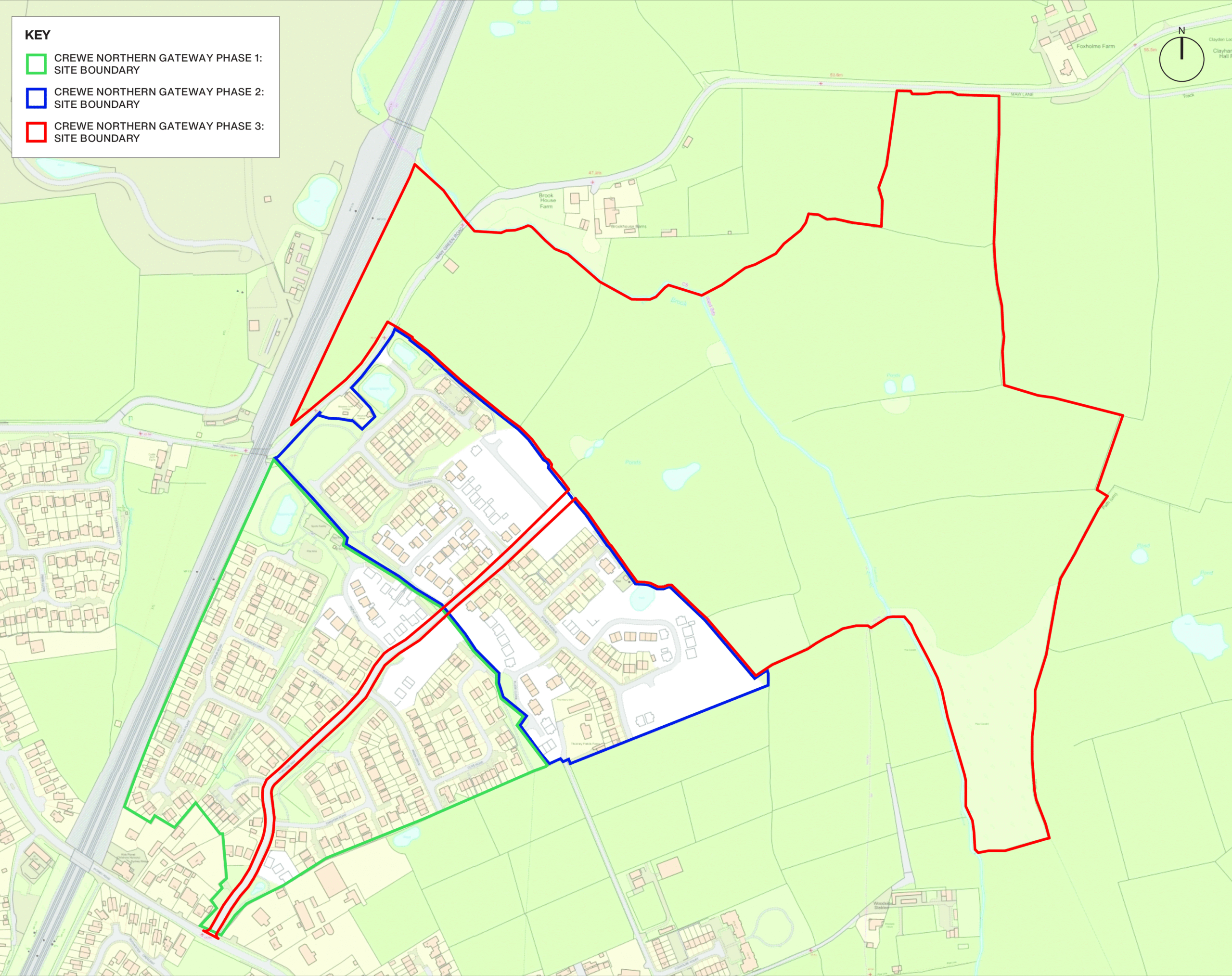
Crewe Northern Gateway: Phases of Development
The site location and phasing plan illustrates the phases of development for the surrounding land and the proposed Phase 3 site.
Phase 1
- Planning Approved (August 2015)
- 240 residential dwellings delivered by Anwyl Homes
- Providing 20% affordable housing, public open space, highways improvements, and a new site access off Sydney Road
- Section 106 Agreement included contributions of £466,390 towards primary education; £506,623 towards secondary education, and £43,000 for off-site footpath and cycle way improvements
- Planning Reference: 13/2055N
Anwyl Homes Development CGI
Phase 2
- Planning Approved (September 2016)
- 275 residential dwellings delivered by Watkin Jones Homes
- Providing 30% affordable housing, public open space, highways improvements, and a new road access from Phase 1
- Section 106 Agreement included contributions of £495,00 for improvement works to either the Sydney Road Bridge or the Crewe Green roundabout, or both. £553,000 towards the Project Hungerford Primary Academy 1FE Expansion, and £136,500 towards the costs of additional special educational needs accommodation at Park Lane School and/or Springfield School.
- Planning Reference: 15/0184N
Watkin Jones Homes Development CGI
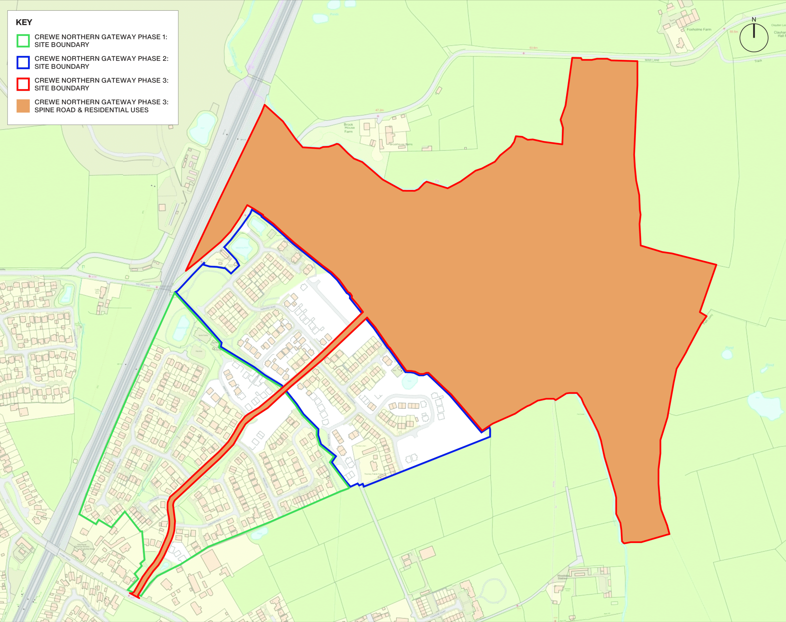
Phase 3
-
Proposals for around 530 high-quality homes, offering a variety of sizes and tenures to meet diverse housing needs.
The development will include 30% affordable housing, sustainable drainage systems, habitat areas, and supporting infrastructure such as public open spaces, landscaping, drainage, and access routes.